An important part of NASA's mission has always been to explore, to discover, and to understand this world from the unique vantage point of space. They now operate 18 of the most advanced Earth-observing satellites ever built. We can share these newly gained perspectives too, and this project is a good way of doing that.
The original Blue Marble was a composite of four months of MODIS observations with a spatial resolution (level of detail) of 1 square kilometer per pixel.
These new monthly images reveal seasonal changes to the land surface: the green-up and dying-back of vegetation in temperate regions such as North America and Europe, dry and wet seasons in the tropics, and advancing and retreating snow cover.
From a computer processing standpoint, the major improvement is the development of a new technique for allowing the computer to automatically recognize and remove cloud-contaminated or otherwise bad data—a process that was previously done manually. The ability to create a digital image that provides great detail in darker regions, such as dense tropical forests, without “washing out” brighter regions, like glaciers, snow-covered areas, and deserts is another of the key improvements,
Pale Blue Dot
Another picture of our planet. From more than 4 billion miles away.

And, comparatively close by ...
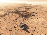
Space4case Mars Gallery 2006 - Recent 3D renderings of the surface of Mars. Beautifully done.

- [NB: The original linked from here is ... considerably larger. You might prefer to look in the Gallery linked above first.]
A personal site mostly using the Terragen landscape generating software. The artist, Kees Veenenbos, has also tried images of other parts of the Solar System, and had a go at depicting a view near a known extra-solar planet.


No comments:
Post a Comment